
Walk a Spokane Valley Street
A street-by-street search begins with one valid address and expands one parcel at a time. SCOUT supplies the county parcel key and physical address. Valley Viewer shows the parcel among nearby shapes and civic layers. The Auditor index connects a legal description or party to recorded instruments. SmartGov can add permit dates and named contacts. None of these alone establishes everyone who lives at the address.
The best Spokane Valley street directory result keeps ownership, occupancy clues, and place context in separate columns. A voter registration is a dated election record. A deed documents a land transaction. A permit identifies an application or site contact. A reverse directory reports what a publisher printed for one year. Compare them only after normalizing the street form and checking that the parcel or legal description matches.
- Validate the mailing form through USPS, including directional prefix, suffix, and apartment or suite.
- Enter the address in Spokane County SCOUT and record the parcel, situs, city, status, and property type.
- Open the same location in Valley Viewer, then inspect adjacent parcels and relevant map layers.
- Use the parcel or legal description in the Auditor's recorded-document path and SmartGov permit search.
- For a past year, consult the exact reverse directory, plat, newspaper, or census schedule that covers it.
Search Spokane Valley SCOUT Fields
The county Assessor directs public users to SCOUT. Its landing control accepts either a parcel number or an address. The official data dictionary confirms result terms such as parcel number, property type, concatenated site address, street number and suffix, directional prefix, street name and type, apartment, city, status, tax-code area, property use, alternate parcel, size, and unit. Assessor records reach back to 1996.
Physical location and correspondence are different facts. SCOUT uses situs for the parcel's physical place. A tax mailing address may belong elsewhere. A parcel number is an administrative identifier, while a legal description defines the land transferred in a deed. The Assessor does not assign addresses and does not make ownership changes; those changes depend on instruments recorded by the Auditor.
| Search control | Input | Street-directory use |
|---|---|---|
| SCOUT | Parcel or address | Parcel, situs, status, type, tax area, use, and size context |
| Valley Viewer | Address, parcel, or map click | Boundaries and nearby civic layers |
| USPS | Street, unit, city, state, or ZIP | Mailing city and ZIP validation |
| SmartGov Advanced | Site address, city, ZIP, parcel, dates | Permit application chronology |
Note: SCOUT's disclaimer says public data may be inaccurate, so a critical ownership question should be checked against the recorded instrument.
Map Spokane Valley by Address
The city Maps and GIS page links to Valley Viewer and an advanced ArcGIS interface. Search a parcel address or number, or click a shape on the map. The viewer can add zoning, land use, school, fire, water, utility, transportation, critical-area, road, and project context. Construction layers are labeled for 2003-2025, while transportation-plan layers carry their own ranges. Always cite the layer and date used.
This map is the bridge from one address to the rest of a named street. Pan along the road, select each parcel separately, and record only the public parcel key needed for the next search. No automatic neighbor or occupant roster was exposed in the researched interface. If a popup field is important, verify it in the live viewer rather than assuming a label from another county's system.
Valley Viewer is also the right place to test a city-limit claim. A mailing label or ZIP does not establish municipal jurisdiction. Water, school, fire, and utility boundaries may cross the city in their own patterns, so those layers explain service areas rather than residence.
Spokane Valley Permit Addresses
Spokane Valley's SmartGov advanced search exposes application number, type, process status, submitted, issued, and finaled dates, site address, site city, site ZIP, parcel number, primary contact, and primary contractor. Its basic dashboard accepts a permit or license number, address, or name. These controls make permits useful for checking when work was proposed or processed at a site.
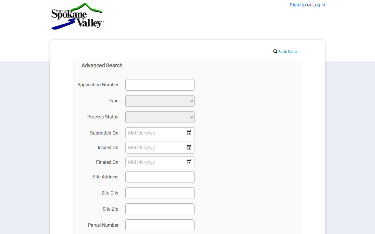
The captured form shows which address and date fields can be searched without reproducing a private result. Keep the output tied to the permit application. The portal states that permit issuance does not establish ownership, and an applicant's claim of authority is not an assessor finding.
Temporary addresses can change before permitting is complete. Spokane County's BP-15 guidance explains that addresses are assigned through the permit process for emergency response. County Building and Planning, at 1026 W Broadway in Spokane, handles the county addressing path and can answer assignment questions at 509-477-3675.
Spokane Valley Street Record Chain
Each address-keyed source answers a different question. The Spokane Valley street directory becomes reliable when the same parcel and date connect those answers. Start with current geography, move to the transaction or permit index, and add a person-linked source only when its access rules permit that use. When a source has no online image, use the counter, public computer, request form, library, or archive channel documented by its custodian.
| Address source | Official keeper | What the result means | Available channel |
|---|---|---|---|
| Parcel card | Spokane County Assessor | Situs, parcel, property and ownership context | SCOUT online; history back to 1996 |
| GIS parcel map | Spokane Valley GIS | Parcel shape, zoning, districts, utilities, hazards, projects | Free Valley Viewer and Advanced map |
| Recorded instruments | Spokane County Auditor | Parties, date, document type, recording and legal-description trail | Web index, public computers, office copies |
| Voter extract | Washington Secretary of State | Dated registration address and election fields | Request form and statutory agreement |
| Permit application | Spokane Valley Permit Center | Site, status dates, parcel, and named application roles | SmartGov; city request if needed |
| Reverse directory | Library or archive | Publisher's year-specific address-to-name entry | Restricted room, appointment, or research request |
The parcel number links SCOUT to map and permit work. The legal description is stronger for a deed trail because it can survive a street-label change or parcel split. A full address can support a voter or directory match, but only with the record date. Do not collapse owner, taxpayer, applicant, voter, and occupant into one label.
Auditor Records Along Spokane Streets
The Spokane County Auditor's recording office indexes deeds, deeds of trust, liens, maps, surveys, and other instruments. Before June 3, 1996, recording numbers use ten digits with volume and page. Later recordings use seven digits without that pair. That format clue can rescue a failed lookup and identify which office aid to request.
Open the recording index, use the fields available after public login, and consult the document-code help. The unattended research could not confirm the exact post-login controls, so no unverified button or export is promised. Images for maps, plats, surveys, and selected records may be online. Some images are withheld when protected identifiers appear. Public computers at 1116 W Broadway provide another route, and written searches or copies can be ordered from Recording.
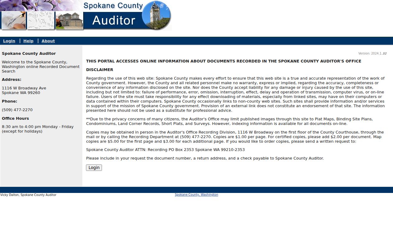
The portal is an index, not the deed itself. Copy and certification charges vary, and the fee page should be checked on the day of the request.
Address Terms in Street Records
A few terms keep the street-by-street chain accurate. Use the word printed by the custodian instead of translating every field into “address.” This matters when tax mail goes elsewhere or an old plat predates the road name.
- Parcel
- An administrative land unit and number used by the assessor.
- Situs address
- The physical location recorded for a parcel.
- Legal description
- The land description used in deeds and plats.
- Plat
- A recorded map of an addition, lots, boundaries, or survey context.
- Criss-cross directory
- A directory arranged by street or phone number rather than only by surname.
Spokane parcel numbers also encode geography. The Assessor FAQ says the fifth digit can identify a quarter section, with codes for northeast, northwest, southwest, southeast, multiple quarters, or multiple sections. Treat that as a clue for spotting a typo. It never replaces the parcel record or legal description.
Older Spokane Valley Street Names
Opportunity, Veradale, Trent, Dishman, Yardley, Greenacres, and Millwood can appear in old directories, maps, school records, township files, and post-office labels. Spokane Valley did not incorporate until 2003. Search the historical community name alongside the modern city name, surname, year, and record type. That method is often more useful than forcing an old entry into today's municipal label.
Spokane Public Library provides city directories, obituary indexes, newspapers, census microfilm, plats, and Sanborn fire maps. The Spokane Valley Heritage Museum holds local papers, phonebooks, school records, business material, and Opportunity, Chester, and Greenacres township records. Digital Archives' Spokane County plats and surveys span 1880-2026, with the current year incomplete. The full collection history belongs on the historical city directory page.
No verified Spokane Valley street-renumbering project with a firm year was found. Do not invent a conversion. Test suffixes, directional prefixes, rural routes, nearby cross streets, additions, and legal descriptions, then ask a librarian, historian, or addressing office when the evidence still conflicts.
Mailing ZIP Versus City Limits
The USPS ZIP Lookup has By Address, By City and State, and Cities by ZIP paths. The address form accepts company, street, apartment or suite, city, and state. Its result confirms a mailing form and recommended city label. It does not prove that a person is present or that the parcel lies inside Spokane Valley.
Confirm the municipal boundary in Valley Viewer. Then retain both findings: the USPS mailing city and ZIP, plus the map's city or service layer. This distinction is especially important near Otis Orchards, Liberty Lake, Millwood, and other east-county labels. A ZIP is a mail-routing tool, not an official resident roster or a city-boundary polygon.
Limits of Spokane Valley Street Records
A Spokane Valley street directory cannot list every occupant. Household members who do not appear in a public source, utility and delivery customers, protected voters, and many motor-vehicle addresses remain outside this method. The Washington Address Confidentiality Program supplies substitute addresses for eligible protected participants. A missing record can also reflect an update delay, spelling variation, inactive parcel, or wrong jurisdiction.
Commercial neighbor tools blend public and privately derived data with uneven dates and accuracy. Official rolls are narrower but disclose their keeper and purpose. Prefer the source record, record its date, and retain only the details needed for the lawful personal task. If a parcel or permit result seems wrong, seek correction from that custodian rather than repeating it.
Lawful use. Spokane Valley address records may support family history, ownership research, civic questions, or scam checks. Never use them to stalk, harass, intimidate, or expose a protected person.
For a broad street, work parcel by parcel and stop when the record no longer serves the stated purpose. A deed seller's later address, an applicant's contact line, or a tax mailing address should not be treated as the current home of that person. The most useful output is a cited chain, not a copied list of names.