
Spokane Valley ZIP Coverage
Five ZIPs form the core working set for Spokane Valley mailing research, with a sixth useful at the Otis Orchards and east-county edge. They are not six clean municipal districts. Greenacres, Veradale, Dishman, Opportunity, Millwood, Spokane, and Spokane Valley can all appear as place labels in records. USPS must settle the mail label for one address, while a parcel map settles the city-limit question.
| ZIP | Areas commonly tied to it | Post office | Research note |
|---|---|---|---|
| 99016 | Greenacres and east Spokane Valley | Verify by address with USPS | Delivery area can cross the city line |
| 99027 | Otis Orchards and east-county edge | Verify by address with USPS | May fall outside municipal limits |
| 99037 | Veradale and east Spokane Valley | Verify exact station with USPS | Mail and city geography may differ |
| 99206 | Dishman, Opportunity, west and central Valley | Spokane-area delivery; station varies | Common Valley ZIP, not boundary proof |
| 99212 | Spokane Valley and Millwood contexts | Verify exact station with USPS | Crosses local naming conventions |
| 99216 | Central Valley and Spokane overlap | Verify exact station with USPS | Older state list names both cities |
Other 992-series ZIPs can appear in Spokane-area, post-office, or edge records, but the research found no basis to treat them as standard Spokane Valley city-limit ZIPs. No official boundary polygon or verified local ZIP realignment history was located. That gap is important: a static colored ZIP map should not be passed off as a current legal city map.
The post-office column stays cautious for the same reason. The official lookup assigns delivery details address by address, and no inspected source supported one fixed station for every household in a code. A named station can serve routes that cross a neighborhood or municipal line. Validate the street and unit first, especially near Millwood, Otis Orchards, and the eastern county edge.
Validate Spokane Valley ZIP Codes
USPS ZIP Code Lookup is the official source for current mailing validation. It offers By Address, By City and State, and Cities by ZIP routes. The address form uses company, street, apartment or suite, city, state, and ZIP fields. Street, city, and state are the key inputs for the address tab. The result confirms the deliverable mailing form; it does not identify a resident, parcel owner, neighborhood association, or municipal jurisdiction.
| USPS field or mode | Use in a ZIP search |
|---|---|
| Company | Optional business name tied to delivery |
| Street and unit | Exact delivery point, including apartment or suite |
| City and state | Mailing locality supplied for validation |
| ZIP | Known code to confirm or search by city list |
| Cities by ZIP | Recognized mailing city names, not legal boundaries |
Preserve the USPS form of the address in your note. A directional prefix, street suffix, or unit number can control the match. Search portals may accept a normalized variation, but the final citation should retain the official source spelling and the date checked.
Spokane Valley Mailing Labels
Mailing city and municipal city answer different questions. A 99216 result can use Spokane or Spokane Valley context, and a 99016 delivery area can reach the nearby county edge. Historical Washington Department of Health corresponding-ZIP material from 2008 links 99206 and 99212 with Spokane Valley, 99216 with Spokane and Spokane Valley, and 99223 with Spokane. That document is a dated correspondence list, not a current boundary table.
Older Valley community names also remain useful. Opportunity, Veradale, Greenacres, Trent, Dishman, Yardley, and Millwood can appear in catalogs, plats, news archives, or old address lines. Search both the old community and Spokane Valley when a dated record predates incorporation or uses a long-standing local name. Do not rewrite the old label in a citation, since that label may be the key to the next record.
This is a geography clue, not proof of a person’s location. A catalog entry under Veradale may describe a family or business at a past date, while a current USPS result reflects today’s delivery format. Label both dates and keep the source terms intact.
Find Spokane Valley Residents by ZIP
Only one inspected local portal documents a direct ZIP field: SmartGov Advanced Search includes Site Zip for city permit research. SCOUT accepts a parcel or address on its public landing page, not a documented ZIP-wide query. Valley Viewer accepts parcel address, parcel number, or a map click, not a documented ZIP filter. The Secretary of State voter request selects files and counties; ZIP may exist in the delivered data, but the public form is not a browse-by-ZIP directory.
- Check the full address in USPS ZIP Code Lookup and save the official mailing form and date.
- Use SmartGov Site Zip when the question concerns Spokane Valley permits. Add date or status fields to keep the result set focused.
- For a known property, search SCOUT by address, then confirm its municipal setting in Valley Viewer.
- If lawful election research requires an extract, follow the Secretary of State agreement and document the file date. Do not publish a voter list.
- Once the ZIP narrows to a named road, use the Spokane Valley street directory for address-level methods.
A ZIP code directory narrows geography; it does not prove that a person lives within it. Ownership, a permit contact, registration, and mail delivery are separate facts with separate dates.
Filter Spokane Valley Permits by ZIP
SmartGov Advanced Search supports Application Number, Type, Process Status, Submitted, Issued and Finaled dates, Site Address, Site City, Site Zip, Parcel Number, Primary Contact, and Primary Contractor. Required fields and dynamic dropdown choices were not exposed in unattended research, so begin with Site Zip and add one relevant constraint. A permit result records an application or project role; the portal itself says permit issuance does not establish ownership.
The official advanced search screen below shows the local permit search surface. It is useful when ZIP is paired with a date, parcel, or application status.
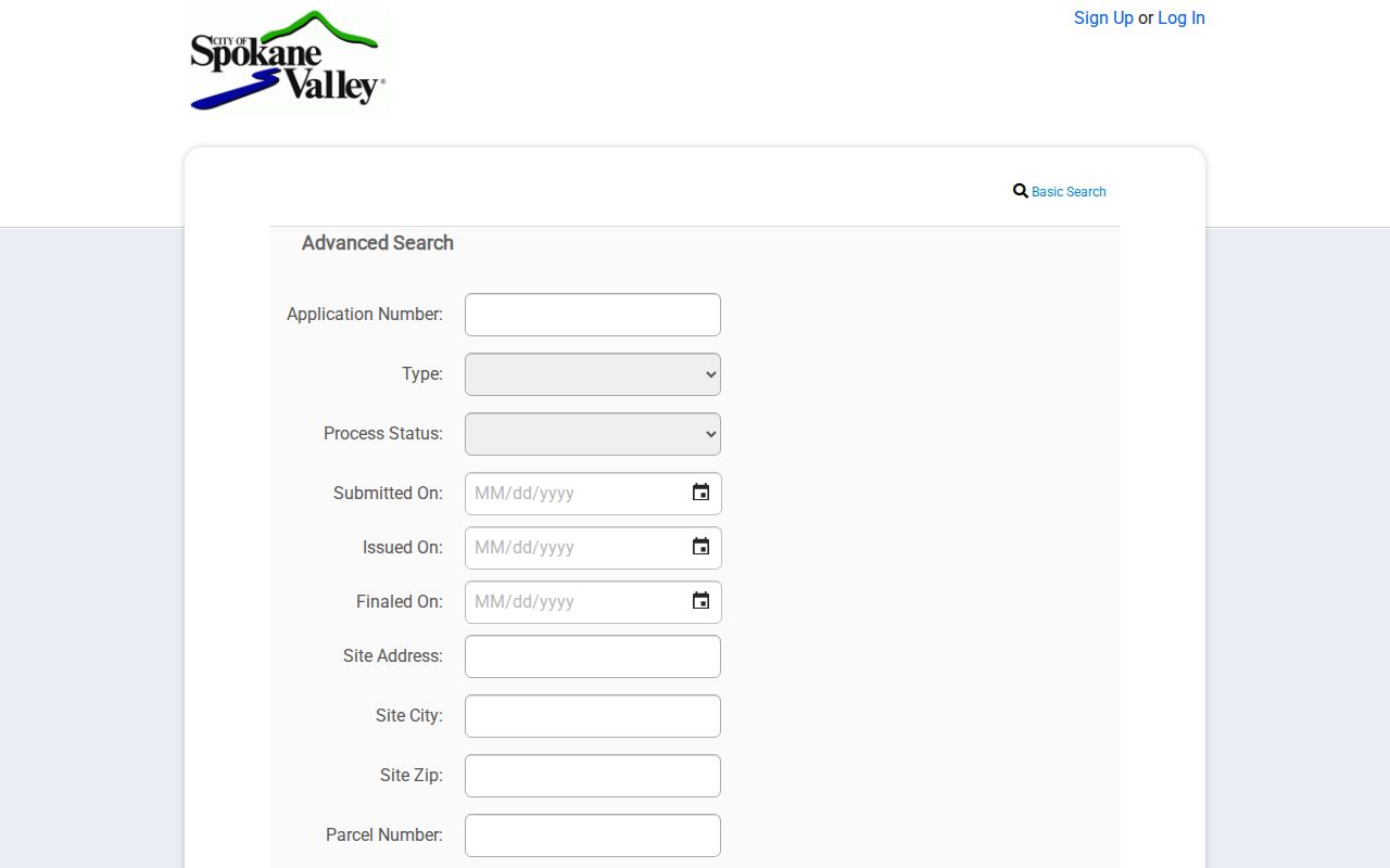
Compare any permit address with USPS and the parcel map before treating the city or ZIP text as boundary evidence.
Map Spokane Valley ZIP Results
SCOUT supplies parcel and tax context for a known address, with assessor records available back to 1996. Its result vocabulary can include situs address, ownership or mailing context, parcel status, property type, and size. A situs address is the physical location assigned to the parcel; the tax mailing address can differ. The county warns that data can be inaccurate, so cite the retrieval date and use the Auditor’s recording system when the legal deed chain matters.
Valley Viewer adds the municipal and service geography. Search a parcel address or number, or click the map, then inspect layers for zoning, schools, fire, water, utilities, transportation, critical areas, and projects. This is the right second step after a Spokane Valley ZIP code directory result because it can show why a valid Spokane Valley mailing address sits in a different jurisdictional setting. Layer dates vary, and the map is not a resident roster.
Spokane Valley ZIPs and City Limits
Spokane Valley incorporated in 2003, while USPS mailing geography serves delivery needs and can cross city boundaries. Planning and possible annexation areas can change municipal context without forcing a matching change in the mailing city. For any boundary-sensitive record, cite two sources: the USPS result for mail and Valley Viewer or SCOUT for the parcel. State plainly whether the conclusion is postal, parcel-based, or municipal.
These terms prevent common mix-ups in ZIP code research.
- ZIP and ZIP+4
- A five-digit delivery area and a more precise four-digit extension for a delivery segment.
- PO-box ZIP
- A code or use centered on post-office box delivery rather than street delivery.
- Unique ZIP
- A code assigned to a single high-volume organization instead of a neighborhood.
- Carrier route
- A delivery path used by a postal carrier; it is not a city district.
Read Spokane Valley Address Details
Spokane County’s BP-15 addressing guidance treats an address as a public-safety tool for E911 response. It also explains number display and rural sign placement. New projects can use a temporary address before final approval. That is why a recent permit, parcel record, and USPS lookup may briefly show different forms. Keep the dates and do not assume one system is wrong without checking its purpose.
Apartment designations, directional prefixes, and suffixes such as Road, Avenue, or Court can affect search matching. Use a normalized version only to locate the record, then quote the address exactly as the custodian displays it. A missing unit may collapse several delivery points into one street address, while an old community label can route historical research to a different catalog entry.
Cite Spokane Valley ZIP Evidence
A reliable ZIP code directory note identifies the full address, official source, date checked, and the kind of geography shown. USPS supports mailing conclusions. SCOUT supports parcel context. Valley Viewer supports mapped city and service layers. SmartGov supports permit-site fields. A county precinct map may show election geography, but it is a planning aid rather than a definitive postal polygon.
No verified citywide ZIP-by-ZIP population, voter-registration, or permit-statistics table was found in the official sources. Avoid inventing counts from partial records. If a current post office or station assignment matters, use USPS for the specific address instead of assigning one station to an entire ZIP. This modest claim is more useful than a broad but unsupported map.
Boundary check. Confirm the mail label with USPS and the city limit with a parcel map before describing a Spokane Valley location.